Mount Manabú was supposed to be an easy climb. Until we lost our way.
Everybody’s favorite Pinoy Mountaineer, Gideón Lasco, wrote: “Because of its easy access, short trail, and very beautiful environs, Manabú Peak is a great introduction to hiking for beginners.” And so after years of prodding, I was finally able to convince Yeyette to experience the “chilly thrill of being up there” by trying out this easy-to-climb mountain in nearby Santo Tomás, Batangas.
We left early morning last 30 May, during the last days of summer. We did not plan to stay there overnight. We do not have camping gear. And even if we did, I am not really fond of staying up there even if for just a night. Yeyette even forgot to bring extra shirts and power snacks. Upon reaching the entrance trail to the mountain, we were lucky to have found a small store there where we bought a couple of junk foods. This lack of preparation was my fault: I shouldn’t have let a neophyte hiker do the packing for us.

On our way to Mount Manabú. Beyond is the Malipunyô mountain range which is composed of three peaks: Malipunyô, Susong Dalaga, and Manabú.

Register here (for only ₱10.00 per person).

The climb to the top begins here.
We started the hike at around 9:30 AM. As we followed the trail, we passed by thick grasses and foliage, encountered wild mountain flowers and even farm animals which urban people don’t see anymore for obvious reasons. Although we have been to such places before (especially me), this abundance of nature never fails to thrill both of us.

A horse is on our way!

A bitter gourd (ampalayá) plantation at the foot of the mountain.

And now we got cows.

This map only got us confused later on...

Going higher and higher.

Boulder man.

Met some hikers who were descending. They spent the night at the peak.

Mountain spring!

¡Pahiñgá muna!

=)

To the grotto.

Violet mountain flowers! What are they called?

Wild pineapple!

The grotto fronting a spring.

Mt. Manabú's Marian grotto.
The estimated time of arrival was 11:30 AM to 12:00 PM. I planned for us to stay at the peak for about an hour or two.
But that didn’t happen.
Confusion began as soon as we reached the grotto. After staying there for awhile, we followed a small sign which says Station 8 that was perched on a tree branch to the left of the grotto. Underneath the sign was a trail, or what looked like a trail. But to the right of the grotto, there was another trail. And it sloped so high and looked a bit difficult to tread on that we quickly assumed it might lead to nowhere (because before reaching the grotto, the trail to the top has been an easy one)


Going farther on to the wrong trail (which was fast disappearing in the foliage), we saw this lone image of the Blessed Virgin.

The roof of the hut fronting the grotto (behind Yeyette).

Getting steeper and steeper...

The trail disappeared somewhere here. Or what we thought of as a trail.

¡Pahiñgá ulít! We realized that we're already lost. We were just not admitting it to each other.
After what seemed like hours of difficult climbing (we were virtually using our hands to hold on to trees and the soil just to keep us from rolling down to sea level!), I realized that we were lost. I knew that Yeyette knew that we were lost, but I did not want her to panic. The reason why we refused to go down is because of the Station 2 map whose photo we took.

The red line shows the wrong trail that we followed because of a Station 8 sign stupidly hanging on the wrong path. And speaking of stupid, I mistook North for East, and vice versa. But that is because the trail on the map was horizontally placed instead of vertical. Ah, so many excuses, LOL!!!
Besides, it is pretty tiring to go down just to look for the correct trail and then climb up again. And worse, our water supply was not enough. To our mind, trudging upwards will lead to the same peak, anyway.
Little did we realize that we were already on the wrong mountain. Not on the wrong side, but literally ON THE WRONG MOUNTAIN.

Sobrang taás nitó sa malapitan.

Wild jackfruit!

The vegetation gets thicker and thicker, blocking our way.

Yeyette's rash guard was not able to protect her from rashes caused by these prickly stuff. Probably the lipâ pricklies (yep, that's where Ciudad de Lipâ got its name).

If it were raining, this boulder would have rolled us over! Even light rains over the mountains could cause huge rocks to slide down.

Yes, there are bayucô snails up here! We learned later on that these snails are edible and are actually exotic and rare!

When we descended, residents said that bayucô can only be found on the highest parts of the mountain. That means weve reached the top of the mountain already when this photo was taken! But where's the freakin' trail?!

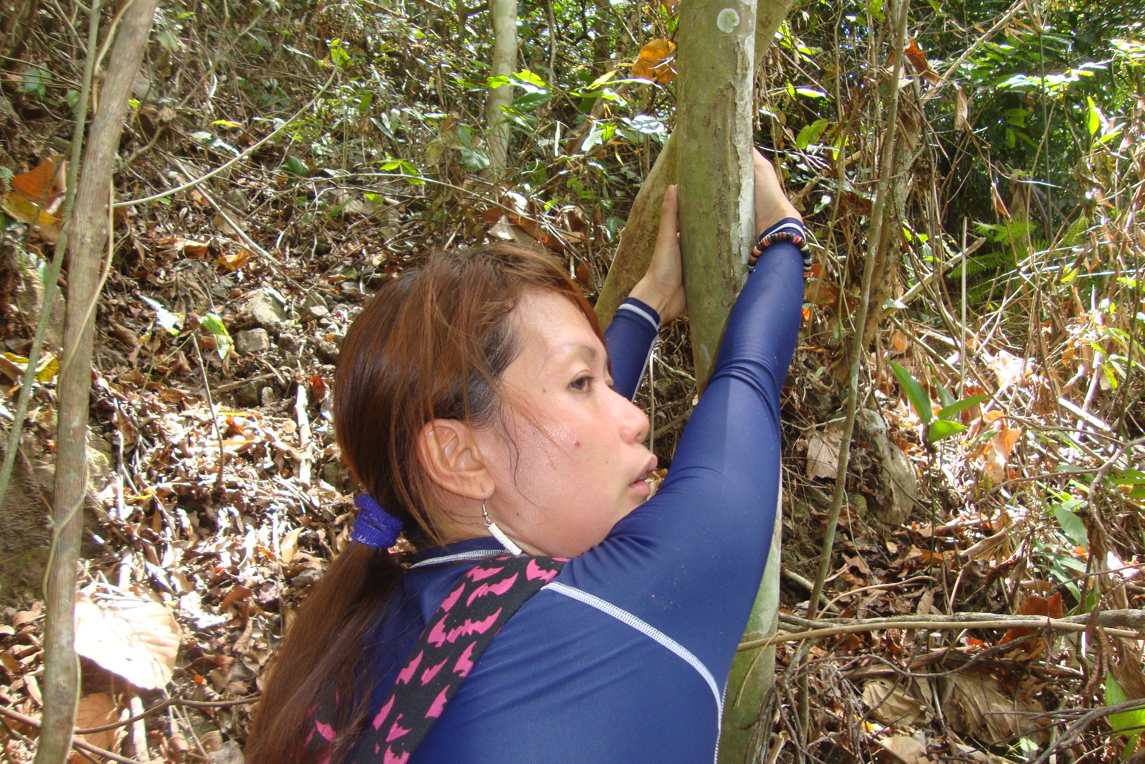
This spiked tree wounded my wife's right hand.

Mushrooms feasting on a dead tree trunk.

We were virtually hanging on to trees in order to avoid rolling downwards -- the ground up here is almost vertical!


From this vantage point, I was so sure that we're no longer in Mount Manabú!
We reached the top, at last. But it did not fit Gideon’s description of Mount Manabú — because we were in the middle of a tropical forest! The sounds that unseen animals and birds produce from up there were quite eerie. We have exhausted our bodies, and I was on the verge of dehydration (I drink a lot of water even at home). There was nowhere else to go, and we could not even find the “trail” that we were following anymore.

Getting dehydrated here due to lack of water.

Mushrooms on the ground.

Sampinít, but unripe.
During the climb, I was looking at our digital camera from time to time, probing the picture that I took of the trail map from Station 2. Suddenly, I thought of tilting the camera sideways, then realized a scary mistake.
We were following a different trail which is not really a trail! After thoroughly examining the photo, and using my “mind’s compass” by checking out the position of the sun, I turned my head through the foliage, and there. From afar, I saw the mountain where we were supposed to go…

Mount Manabú is over there! We are indeed on a different mountain!
There was no other option but to descend. And while our ascent was tiring and difficult, the descent was almost impossible, for the way down tilted crazily, almost vertical. Some of the sites that we passed by was possible to climb on, but virtually impossible to descend to. There were just so many ravines. And I could even feel my legs and knee giving in whenever I use them to balance my body with gravity. Twice, I almost rolled downwards when I stepped on loose soil, or when some plants that I was holding on to keep myself from falling also gave in. And during those times, my wife immediately grabbed my arms, thus saving me from getting killed or paralyzed.
And I loved her even more for that. =)
For all the bravado that I have of being an experienced mountaineer, a neophyte –and my wife at that!– saved my @$$, hahaha!
We continued the perilous descent, shouting occasionally for help, hoping that somebody will hear us and lead us to the right track.

The tiring descent begins...

Deathly steep!

Used vines to get down.


We made it! Just a few more ravines!

A home for wasps (putactí) up there on that tree!
Finally, in what seemed like forever, we noticed that we were finally on level ground. But we were still lost.

Sea level at last!

What are those -- some sort of cabbages?

Pardon my ignorance. I really don't know what this is. But it looks delicious, hehe!

We've reached the bottom, yes. But the place is unfamiliar. Definitely NOT the place where we started trekking. Which means... WE'RE STILL LOST!

Lookin' for help.

¡Nuno sa punsô!

Still in the middle of nowhere.
Finally, people! We saw some a small settlement of Batangueños who told us that Mount Manabú was far, far away!
Darn, we descended on the wrong side of the wrong mountain!
We told them that we were already climbing the said mountain, until we got lost. They were very surprised to hear how we reached the peak of a mountain that is never visited even by residents of Santo Tomás. Then, in true Pinoy fashion, some of them recalled stories of how some mountaineers did lose their way in the past, perhaps due to unseen and playful spirits (probably of the infamous ticbalang). Of course I didn’t buy it; my provinciana wife did, LOL!!!
But at the very least, we were still in Santo Tomás. The mountain which we climbed was a nameless one (but some of them call it Santa Cruz). They said that people rarely go up there because it is very dangerous!

At last, people! They provided us with water, and confirmed that we were indeed in the middle of nowhere!
It was past 2:00 PM. It was OK for me to go home. Anyway, what we climbed was a mountain. But Yeyette was still raring to go for Mount Manabú! ¡Guay! That was the mountain we came for in the first place.
One of the old ladies there (the one with the eye patch) accompanied us to the main road (actually a dirt road) and pointed to us the correct way towards Barrio Santa Cruz where we can start our climb to Mount Manabú once more. We also asked if there was any nearby sari-sari store where we can have eat and buy drinks. Luckily, there is one about half-way towards the entrance trail to Mount Manabú, and it’s owned by her relatives. The road had no vehicles, somewhat deserted. So we had to walk about a kilometer towards that store.

The Batangueños in the previous photo led us to this road which links Santo Tomás, Batangas to San Pablo, La Laguna. It will also lead us back to the foot of Mount Manabú.

Dead tired but still smiling. =) What an adventure!

Chickens!

We had some refreshments at a store behind this milestone.

The people who own this store are related to those Batangueños in the earlier photo who helped us earlier. Íisang pisâ cung tauaguin sa nayon.

I don't like eating pancít cantón with rice. But with what we went through, the heck with fussiness! The meal turned out to be delicious! And best of all, the rice was free!

Lancâ (jackfruit).
After refreshing ourselves at the store, we met a certain Tanó, also a relative of the one-eyed lady we met earlier. He offered to guide our way so that we won’t get lost. And he knew of a nearer trail from the store. It was almost 3:00 PM, but he assured us that we will reach the peak before dark.
I asked Yeyette again if she still wants to pursue the climb. She said yes. She was enjoying every minute of our adventure, and I’m happy about it. So off we went for our second mountain that day!

The second trek commences a few minutes past three in the afternoon. Cuya Tanò went with us as a guide. He's also a relative of those Batangueños we met earlier.

We started off on a different trail, a place few mountaineers are aware of!

Crossing a crystal-clear stream.


Afternoon laundry.

The land goes up again.


A mahogany forest, as far as the eye can see!


Our destination: the white cross of Mount Manabú, located at the peak.

That hut on the other hill is where we originally trekked before we got lost. It is near Station 2.

The original trail and the new one that we're following merges here!

Free this monkey!

Free these rabbits and hamsters!

Station 2 again. They sell fresh coconut juice here. Yeyette saw an ex-officemate of hers with the latter's friends. They had just arrived and will spend the night at the peak.


Tunay na lacás -- Ralph Recto, ¡hahaha!

We had to go ahead of them because we were in a hurry. Besides, we did not bring any camping gear.

The hike resumes.

The fun climb turned into a fast one because dusk was just about two hours away. We had to reach the peak fast enough in order to stay there a little bit.

They say that mushrooms which grow from dung can give a much stronger high compared to what marijuana and talampunay can offer. And it is said that this crappy li'l mushroom costs high in the black market!

To Cuya Tanó, this climb's a piece of cake. My wife says otherwise.


At last! A clearing! We're out of the dark woods!


Ciudad de Lipâ and the town of Cuenca, Batangas in the background.

We're near the peak!

The brown tract of land from afar is the peak of Mount Manabú.


As we neared the peak, we entered another forest.


More of the edible and sweet sampinít or wild mountain berries. Although its season is summer, these in the photo are still unripe.

Warning: this sign leads to a ravine! Obviously a cruel prank (I wasn't able to remove it because it was situated in a very dangerous area where it is not impossible for one to fall down). Just ignore it.
Finally, we reached Mount Manabú peak a few minutes past five in the afternoon. Because it was just her first time to reach a mountain peak, all of Yeyette’s exhaustion suddenly vanished! But I could not wait to lie down on the ground for a quick rest!

Aaaaaaaahhh! The peak! Finally!

Thank the Lord, we still made it in just two hours despite our exhaustion! The white cross, by the way, was constructed by Cuya Tanò together with some of his friends and relatives many years ago.

It's her second mountain peak in just one day! And this is just her rookie climb! Try to top that!

The mighty Monte Banahao is behind Yeyette. The mountain is shared by the municipalities of Lucbán, Quezon and Majayjay, La Laguna.

The municipalities of Lucbán and Sariaya in Quezon province behind us.

Thick forest below!

The sun is about to set on Lago de Taal.


Ang aming cauntíng báon.


My wife's ex-officemate and her crew still far below us.

Monte de Maculot in Cuenca, Batangas. I've climbed this mountain on my 26th birthday (07/18/2005)!

The mysterious and somewhat mystical mountain of Banahao.

Faraway La Laguna de Bay.

A welcome intruder! Cuya Tanò said it's an ulyabíd.

It's raining yonder!

Yeyette's ex-officemate Sierma Limos (left) and her posse arrived just before dusk.


Mang Pirying: the keeper of Mount Manabú
Although it was still summer, the climate was very cold at the peak. But of course; we were on top of a 2,494.75-foot forested mountain. A few minutes past 6:00 PM, we bid goodbye to Sierma and her friends who were staying there overnight. This time we followed a different trail which will pass by the hut of Mount Manabú’s famous resident, Mang Pirying.

Descending. These thick ropes are used by mountaineers during slippery days.


With the Manabú Man himself, Mang Pirying!

Mang Pirying, the keeper of Mount Manabú.
Mang Pirying was a very humble man. A hermit, he has been living in the midst of the mountain for a long time. He introduces himself as a 48-year-old man, but he looks older (Cuya Tanò says that he could be in his 60s already). Many people living around the mountain know him. Also, it is not uncommon for hikers to visit him. Besides, Mang Pirying offers them perhaps the best tasting café baraco that I have ever tasted (and it’s all for free)! Freshly brewed! And the coffee beans are from his small plantation beside his hut.
I told him that he’s quite popular in the net among local mountaineers. But I don’t think he understood what the internet is.
We told Mang Pirying of the early day’s adventure, of how we got lost and found our way down. Then he told us that it could have been us who he heard shouting for help from the other mountain which he called Aluyan. So that first mountain is still officially nameless, indeed, for people sometimes call it either Santa Cruz (or Holy Cross in English, perhaps named after Barrio Santa Cruz where Mount Manabú is situated) or Aluyan. Ironically, Mount Santa Cruz has no cross. But Mount Manabú, which has a white cross on its peak, is not named as such.

After the brief pleasantries, we had to leave because it was very dark already.

Darkness fell.


Back at Station 2. There are no more buco juices left.

The people over at Station 2 provided us with this torch which they call cuyóg. It is made up of dried coconut pulp.

Back from where we began. This house is right in front of the mountain's entrance trail.
Truly, an incredible day. Especially for wifey. Who would have thought that, on her first climb, she will conquer two mountains?! And she’s raring for her second, nay, third, climb with me as soon as the rainy season has stopped.
Enjoy nature, guys, while it’s still there. Because, sadly, it appears that there is no stopping the curse of urbanhood, i.e., pollution, deforestation, . But I pray that Monte de Manabú’s bounty of natural beauty will remain until the end of times.


uy parang ang saya-saya naman ng adventure cum bonding niyong mag-asawa! bilib naman ako kay yeyette. kakapagod yung ginawa niyo ah… baka yung 1 km walk pa lang, di na ko makalakad. LOL!!!
LikeLike
Sama ca minsan sa amin. =)
LikeLike
sama ako minsan 🙂
LikeLike
¡Oo ba! Dapat marami tayo. Yung mga pinsan natin sa Clan Alas yayáin natin. 😀
LikeLike
Un placer leer tu blog.
Viviendo en tierras WASP (Inglaterra, ahora Canada), he leido muchas, pero que muchas biografias e historias sobre que si el Drake, que si la gente del Hudson Bay, que si Wellington, que si Nelson… los cuales han sido hombres con grandes pares, en efecto.
Sin embargo, siempre me ha parecido que falta literatura sobre los espanoles en Filipinas, y sobre los filipinos mismos en ese periodo… aqui tienes tu ocasion de escribir! Anda que no hay libros sobre los conquistadores en america latina, y mucha historia espanola en latinoamerica despues de habernos ido formalmente…. pero nada sobre Filipinas, o Guam.
Ahora que vivo en Canada (en Toronto) me he cruzado con muchos filipinos… que placer! Que gente mas agradable! No se porque, pero inmediatamente siento cierto vinculo con los filipinos, inmediato, es como la sensacion que he tenido visitando Mexico o Chile… Para mi, no es una cuestion del colonista espanol, para mi se siente mas como historia compartida… curioso como los espanoles y portugueses se mezclaron con todas gentes (al contrario que los WASP).
Creciendo en Madrid leia las historias de los espanoles en America, despues cruzando el Pacifico, y decia como es posible que esta gente hiciera estos viajes en esos tiempos?
En fin, que podria escribir mas, pero bueno, espero que Espana y Filipinas se vuelvan a conocer otra vez, creo que seria bueno para ambos.
LikeLike
felicidades! mt. manabu is one of my favorite dayhikes. it’s nice to see that mang pirying, el hombre amable de monte, is still there, as usual. nice writeup!
LikeLike
muchas felicidades! esta montaña es uno de mis favoritos. subiremos monte de balagbad este fin de semana. usted puede unirse si lo desea.
LikeLike
Oh my gossh!
What an adventurous trail you got there.
And it’s filled with so many “attractions” as well.
:thumbsup:
LikeLike
I just want to make clarification about the used of the word “sampinit” in one of the posted pictures, I’m very much sure that was on the picture are not the sampinit that I grew up with.Sampinit for everybody’s information in Katagalugan, specially in cold place (temperature) surrounding Mt. Banahaw and Mt. San Cristobal, is a type of wild berries similar to strawberries. It is called in English as Wild Raspberry. It’s just small, bit rounded, with a tree like rose. Try to visit this URL::
http://kidpawan.blogspot.com/2011/08/sampinit-philippine-wild-raspberries.html
LikeLike
Our guide confirmed to us that they are indeed sampinít. It’s just that they’re not ripe yet, that’s why they look different compared to those in the photos on that link you shared (which are already ripe). But hey, the guide could be wrong.
LikeLike